Geodata
Advertisement
Geodata International v.10.05
Geodata International - World-wide database of countries with georeferenced towns, municipalities, postal codes and administrative units with WGS84 and UTM coordinates and elevations for geocoding, proximity search, navigation, distance calculation.
Advertisement

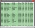
Geo Data Germany v.15.02
The database contain geodata of the Federal Republic of Germany with geo referenced towns, municipalities, town quarters, administrative units, postal codes, telephone preselections, nature areas, landscapes, climatic zones for proximity searches ec.

Geodaten German Admin
The database contain geodata of the Federal Republic of Germany with geo referenced towns, municipalities, town quarters, administrative units, postal codes, telephone preselections, nature areas, landscapes, climatic zones. The data contain coordinates

Geo Data German Admin v.15.00
The database contain geodata of the Federal Republic of Germany with geo referenced towns, municipalities, town quarters, administrative units, postal codes, telephone preselections, nature areas, landscapes, climatic zones for proximity searches ec.
LandMap Vivo v.10 10
Create GPS enabled geo maps directly on the background of aereal photos and road maps from the internet. Import geodata from Google-Earth, OpenStreetMap, GPS tracks and GPS logger. Map editor , manually digitizing.
Geocando v.1 1
Geocando is a 3d Viewer for visualisation and querying of geodata and geomodels. It is especially developed for Paradigm's GOCAD® objects. Another supported format is the typical GIS exchange format ESRI Shapefile.
Geo Data German Admin (English) v.10 2
Geodata of the Federal Republic Germany with municipalities, postal codes, telefone preselections. Suitable for branch searches, periphery searches and distance computations. Georeferences as Gauss Krueger, UTM and geographic coordinates. ORTREF:

Geodaten Deutschland v.18.01
The database contain geodata of the Federal Republic of Germany with geo referenced towns, municipalities, town quarters, administrative units, postal codes, telephone preselections, nature areas, landscapes, climatic zones for proximity searches ec.

OSM Parser v.1.0
With OSM Parser it is possible to process OpenStreetMap geodata for various purposes.
TNTmips v.6.9
About TNTmips- Single product integrating the analysis of topological vector, raster, CAD, TIN, and database geodata.